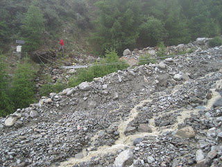
The Mattertal Valley is surrounded by the highest mountains of the Alps Swiss, like the Dom (4,545 meters) and the Weisshorn (4505 meters).
It is an idyllic place to get a real taste of the natural beauty of the Alps.
However, the sublime peace and beauty have often struck by the "beast", mass movements (avalanches, rockfalls, landslides and debris flows) over the course of centuries.
 |
| Mountain torrent Dorfbach, Mattertal Valais (Switzerland) |
 |
In recent years, the risk of these natural hazards seems to have increased likely due to a warmer climate. The glacier retreat and permafrost melting leaves instable rocks and soil. As the permafrost degrades, the risk of unlocking larger amount of rock debris and soil dowslope increases. Heavy rainfall or snow melt could provide the trigger of these natural mass movements, in particular debris flows.
Research activities are carrying on in Mattertal to full understand the debris flow mechanisms from initiation, motion and deposition (Hazard mapping in Mattertal VS: Data acquisition and numerical modeling of debris flows) by SLF-WSL. This is crucial to be able to predict potential debris flow activities and hazard zonation mapping for the protection of life and property.
During spring-summer last year two events occurred. The first one, 7th June 2010, took place without precipitation. In this case the trigger was the water coming from melted snow and ice from the very active rock glacier "Grabengufer". The second event, on the 14th August 2010, unlike, the first rainfall was the trigger. In both events, burst in pulses were observed in the form of intermittent successive waves of different sizes with varying water and solids content.
The most recent event began on the 4th June 2011 from rainfall before and during the event.

The mountain torrent Dorbach (Randa, Mattertal Valais) is located at a debris flow monotoring station. The station encompasses geophones used for seismic data acquisition and as a trigger of the other measurement devices (video camera for visual information, radar for the flow depth and a laser scanner to measure profiles of the torrent geometry which is currently significantly changing).
 |
| Radar |
 |
| Camera |
 |
| Geophone on the rock |
 |
| Fix laser scanner |
I went to Mattertal Valley with part of Perry's group (from SLF and WSL) to collaborate in the current project by taking some measurements with portable equipments. We have used GPS technology to collect field data, a laser rangefinder and a laser scanner.


HI Paloma
ReplyDeleteNice pictures! I hope you are enjoying your time.
Good Luck with your research!
Karwan